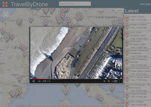
TravelByDrone is a new kind of interactive map, one that could mark a lucrative tool for location-scouting movie producers and travel agents, alike (though to be honest, do people still use travel agents?). The website offers the opportunity to see various cities across the globe from the perspective of drones—"accessible as never before," claims the anonymous creators.The website includes a map covered in drone icons that open YouTube videos seen from a drone's perspective. Some—like the one from Worcester, Massachusetts—are a bit lackluster and simply include teenagers toying with a quadcopter around a college campus. Others, however, offer a genuinely stunning vantage over foreign beach towns and romantic cities from the likes of Spain, Portugal, Argentina, and more.
Advertisement
TravelByDrone also allows users to share their own drone videos from all over the globe. The site notes that "a dedicated team will review the material before validating the request." To be accepted, the submission needs to be taken by a drone (not of a drone), and must actually depict the area where the UAV is flying. Also, military drones and any kind of promotional footage will get the axe.Though the concept may sound problematic, TravelByDrone could be a viewed as a positive tool that even marks a precedent for the future of interactive maps. For example, for those wary of massive information companies sending (probably driverless) cars around your neighborhood to update their street view functions and possibly garner other information, TravelByDrone offers a crowd-sourced alternative. Of course, drones have a greater and more invasive vantage than cars equipped with video cameras on their hoods, but this website's validation process (and anti-military stance) inspires confidence about its intentions for good.If more people begin to submit videos using this tool, pretty soon we could have drones-eye-views of cities that we previously couldn't get a strong online preview of. This could be used for assessing the damage of neighborhoods after natural disasters, watching various cities of the world during moments of global celebration (New Years, the World Cup finals, the Olympics…), or for just browsing around the globe in hopes of discovering a new city that might be worth exploring.
Advertisement
Though drone-aided video monitoring is certainly an issue that will continue to rise with the growing technology, TravelByDrone is a project that encourages us that drones can be used as an information tool that benefits the public. When it comes time for booking our next vacation, we now have a new way to explore foreign locales before buying our plane ticket.Explore for yourself here: http://www.travelbydrone.com/
ONE EMAIL. ONE STORY. EVERY WEEK. SIGN UP FOR THE VICE NEWSLETTER.
By signing up, you agree to the Terms of Use and Privacy Policy & to receive electronic communications from Vice Media Group, which may include marketing promotions, advertisements and sponsored content.